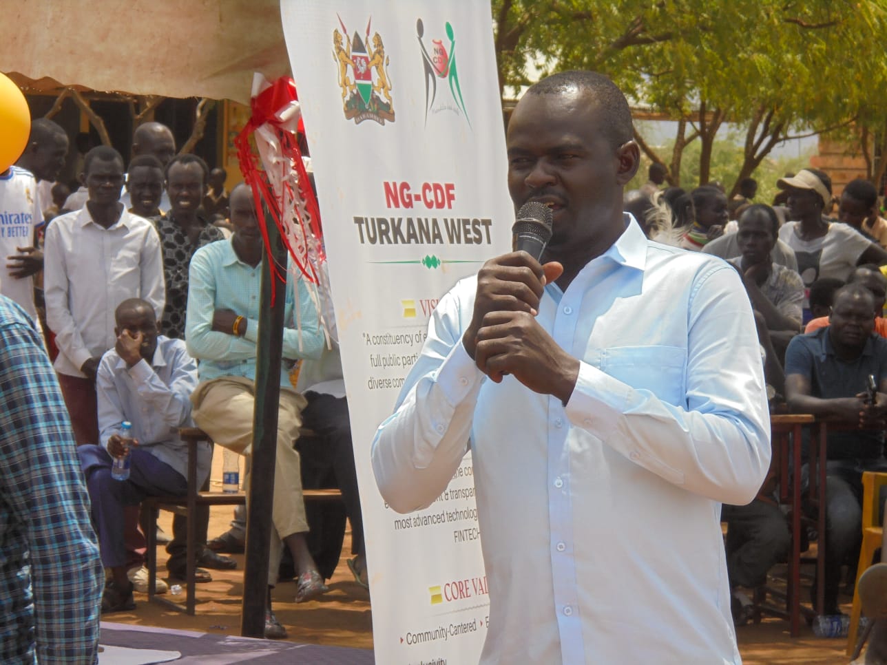
About Us
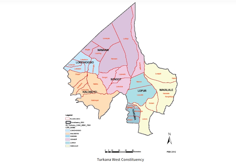
Turkana West Constituency
POSITION AND SIZE
Turkana West Constituency is one of the six constituencies of Turkana County, situated in the North rift of the Republic of Kenya. The constituency is in the north-western part of the country and borders two countries; South Sudan to the north and Uganda to the West. Within the Country constituency borders Turkana North constituency to the West while it borders Loima constituency to the south. The constituency is the largest of the six constituencies in terms of land mass and measuring 16,779 square kilometres. The Constituency houses part of the ILEMI triangle, a disputed region with South Sudan bordering South Sudan and Ethiopia and measuring up to 11,000 square kilometers. This then makes Turkana West border Ethiopia to the North-Eastern side.
ADMINISTRATIVE AND POLITICAL UNITS.
Turkana West Constituency has two sub-counties namely Kakuma and Lokichoggio, with the latter being the later established recently and launched in June 2023. Kakuma sub-county has three divisions namely Kakuma, Oropoi and Letea though Letea is yet to be operationalized. The sub-county has nine (9) locations and twenty four (24) sub locations. Lokichoggio Sub County has two divisions namely Lokichoggio and Nanam divisions. The sub-county comprises six (6) locations and fifteen (15) sub-locations. Kakuma sub-county has four wards namely Kakuma, Lopur, Kalobeyei and Letea each represented by a member of county assembly while Lokichoggio sub county has three (3) members of county assembly representing the wards of Lokichoggio, Songot and Nanam.
POPULATION (2019, 2023 AND 2027) AND SETTLEMENT PATTERNS.
As per the 2019 national housing and population census, the constituency had a population of 239,627 comprising 123,867 male population, 115,758 female population and 2 identified as intersex with settlement patterns primarily characterized by dispersed and nomadic communities. The total households as per the 2019 census was 45,451 households with an average household size of 5.3 and density of 14 persons per square kilometre. The 2023 population is estimated at 264,391 and the same projected to be 301,117 in 2027. This population excludes the refugees in Kakuma which was placed at a population of 250,850 as at December 2022.
PHYSIOGRAPHIC AND NATURAL CONDITIONS.
Turkana West is marked by a challenging physiographic and natural environment. The constituency features arid and semi-arid landscapes, with limited water resources and frequent drought conditions and famines. The topography may include hills, valleys, and flat plains, influencing land use and agricultural practices.
Sector profiles. The economy of Turkana West is predominantly based on pastoralism, with communities relying on livestock for sustenance and trade. Additionally, efforts are being made to diversify economic activities, with some engagement in small -scale agriculture, and emerging entrepreneurial ventures. The constituency is also exploring the potential of renewable energy sources give its exposure to sunlight and wind.
Social cultural issues. Turkana West Constituency is characterized by a rich cultural heritage, with diverse ethnic groups contributing to the social fabric. Cultural practices, traditions and language play a significant role in shaping the identity of the community. The constituency has also faced social challenges related to education, healthcare, and access to basic amenities.
POVERTY LEVELS AND MAIN ECONOMIC ACTIVITIES.
The poverty level in the constituency is double. According to the 2019 Kenya Population and Housing Census, out of 29,365 persons of above 5 years in urban centres only 5,592 are employed with 7,628 unable to find work. In the entire constituency with a population of 205,633 above the age of 5years, 58,378 persons are employed with 47,480 persons unable to find work. In the later, 99,484 persons are said to be outside the labour force while in the former, it is 16,139. This puts the un-employment rate in the urban areas at 58% which is above that of the whole constituency of 38%. This disparity is fuelled by the rural-urban migration as a result of economic hardships in the rural areas and search for economic opportunities in the urban set-up. Poverty levels in Turkana West are often linked to the arid environment, limited economic diversification and vulnerability to climatic changes. The main economic activities include pastoralism, small scale agriculture and trade. Efforts to alleviate poverty may involve targeted interventions that address water scarcity, promote sustainable agricultural practices and enhance education and skills development.
Access NG-CDF Information on your Mobile
County Assembly Wards in Turkana West Constituency :
Kakuma Ward
-
County Assembly Ward No.: 0617
-
County Assembly Ward Name: Kakuma
-
County Assembly Ward Population (Approx.): 33,539
-
County Assembly Ward Area In Sq. Km (Approx.): 1,577.00
-
County Assembly Ward Description: Comprises Morung’ole, Nadapal and Tarach sub–Locations of Turkana County
Lopur Ward
-
County Assembly Ward No.: 0618
-
County Assembly Ward Name: Lopur
-
County Assembly Ward Population (Approx.); 35,664
-
County Assembly Ward Area In Sq. Km (Approx.): 1,992.00
-
County Assembly Ward Description: Comprises Lopur, Lopusiki and Namon Sub-Locations of Turkana County
Letea Ward
-
County Assembly Ward No.: 0619
-
County Assembly Ward Name: Letea
-
County Assembly Ward Population (Approx.): 37,512
-
County Assembly Ward Area In Sq. Km (Approx.): 2,909.40
-
County Assembly Ward Description: Comprises,Tulabalany,Loritit, Loreng, Namorkirionok, Katelemot, Lokipoto and Loito sub–Location of Turkana County
Kalobeyei Ward
-
County Assembly Ward No.: 0621
-
County Assembly Ward Name: Kalobeyei
-
County Assembly Ward Population (Approx.): 16,378
-
County Assembly Ward Area In Sq. Km (Approx.): 1,599.70
-
County Assembly Ward Description: Comprises Kalobeyei, Natiira, Lonyuduk, Nalapatui and Oropoi Sub–Locations of Turkana County
Songot Ward
-
County Assembly Ward No.: 0620
-
County Assembly Ward Name: Songot
-
County Assembly Ward Population (Approx.): 17,624
-
County Assembly Ward Area In Sq. Km (Approx.):2,365.10
-
County Assembly Ward Description: Comprises Lokangae, Lopwarin,Lokudule and Songot Sub–Locations of Turkana County
Lokichoggio Ward
-
County Assembly Ward No.: 0622
-
County Assembly Ward Name: Lokichoggio
-
County Assembly Ward Population (Approx.): 38,699
-
County Assembly Ward Area In Sq. Km (Approx.):1,481.60
-
County Assembly Ward Description: Comprises Lokichoggio, Lokariwon,Loteteleit and Loremeit Sub–Locations of Turkana County
Nanam Ward
-
County Assembly Ward No.: 0623
-
County Assembly Ward Name: Nanam
-
County Assembly Ward Population (Approx.): 27,664
-
County Assembly Ward Area In Sq. Km (Approx.): 3,520.00
-
County Assembly Ward Description: Comprises Lopiding, Nanam, Lomeyan, Lotikipi and Mogila Sub–Locations of Turkana County